Landscape category
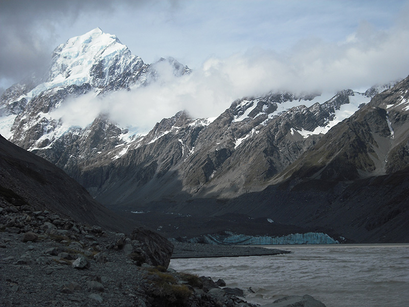
Christmas at Aoraki: mountain, moraine and glacier. 75 kph gale (not pictured) was an uninvited guest.
Photographer: Bethany Fox
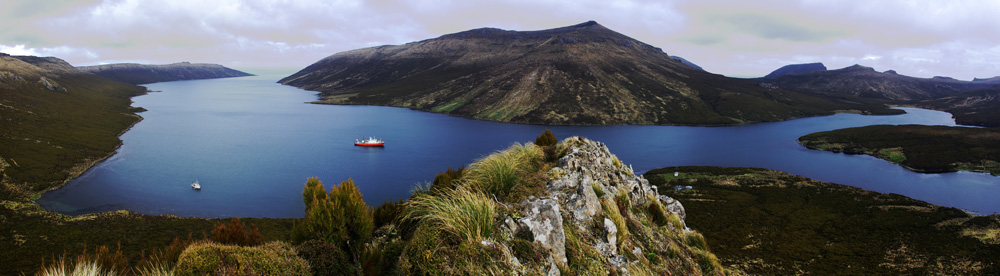
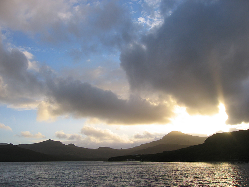
Campbell Island, 700km south of New Zealand: Perseverance Harbour as seen from Beeman Hill. The University of Otago research vessel Polaris II is visible near the bottom left.
Photographer: Pont Lurcock
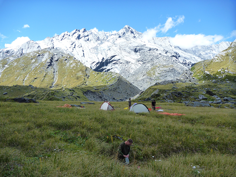
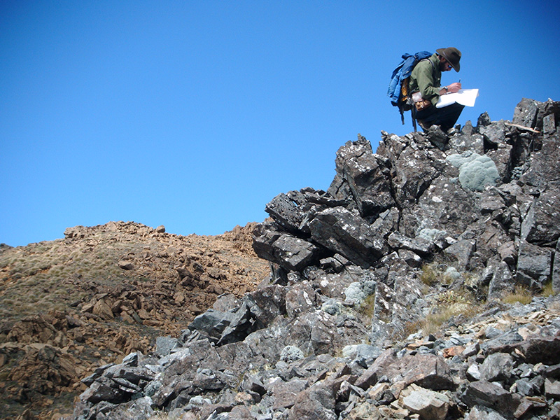
In search of sedimentary rocks in the Dansey's Pass area.
Photographer: Kate McKercher
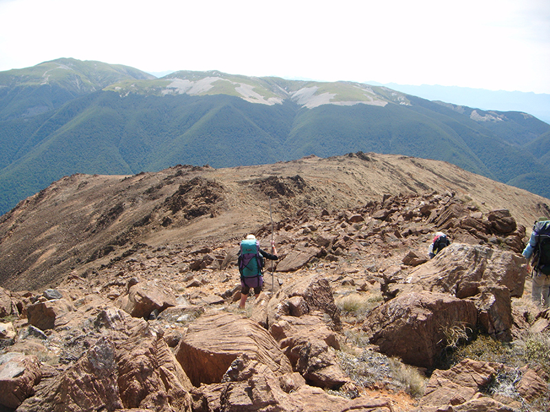
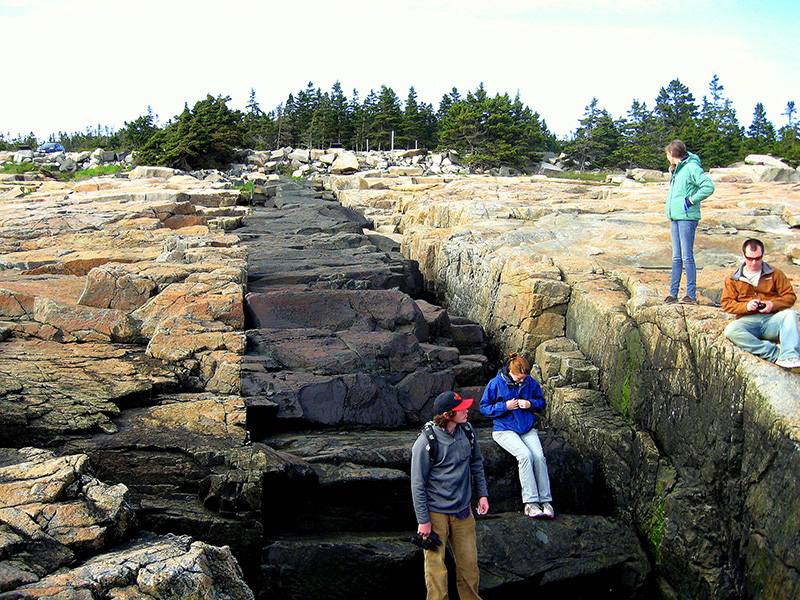
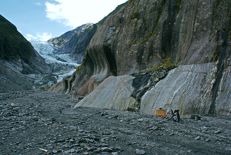
Orographic rainfall forms on the Southern Alps with the deep fault drilling project drill rig in the foreground
Photographer: Hannah Scott
Sunset on the Otago Schist within the Olivine Range.
Photographer: James Scott
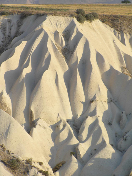
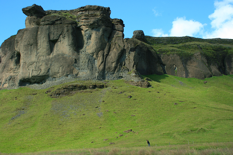
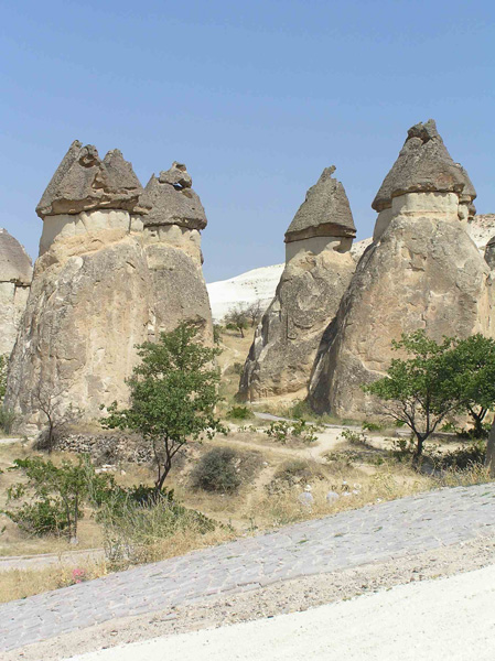
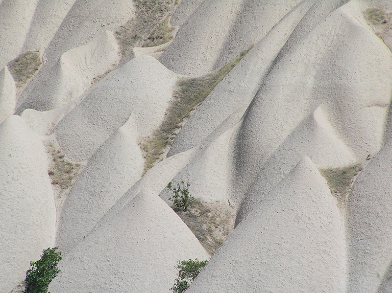
Fluted ignimbrite, Cappadocia, Turke
Photographer: Alan Cooper
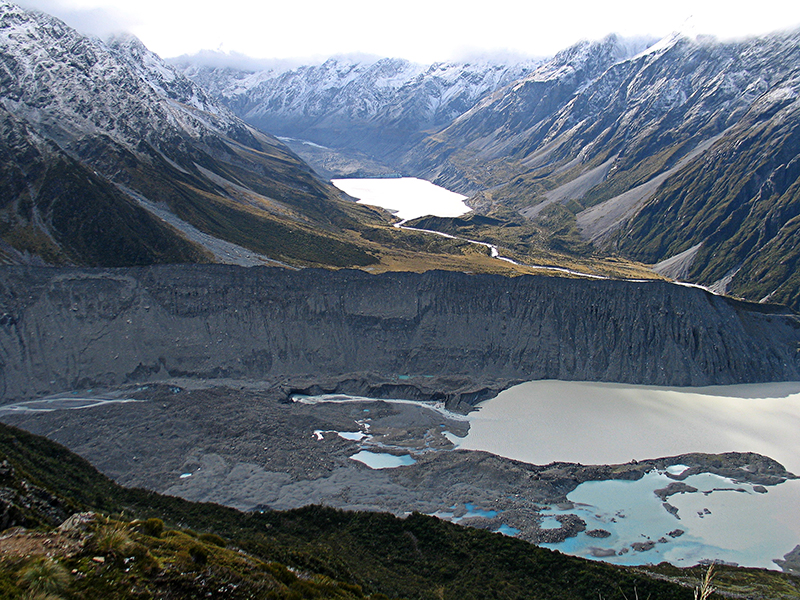
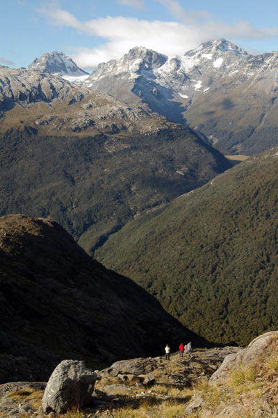
Southern Alps glacial landscape with moraines and terminal lakes of the Mueller Glacier (foreground) and the Hooker Glacier in the distance.
Photographer: Uwe Kaulfuss
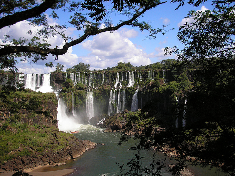
The waterfalls of Iguazú, Argentina
Photographer: Sophie Briggs
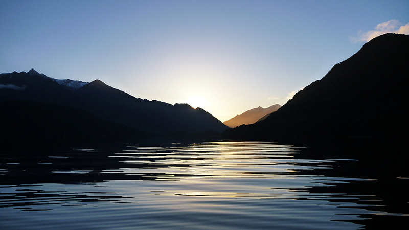
Late evening fieldwork on Lake Hauroko, Fiordland National Park.
Photographer: Ewen Rodway
Laki Lava, Iceland
Photographer: Jack Ensor
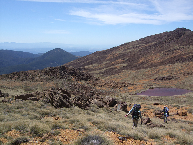
At the head of the Landsborough River, West Coast, New Zealand
Photographer: Willy Sanson
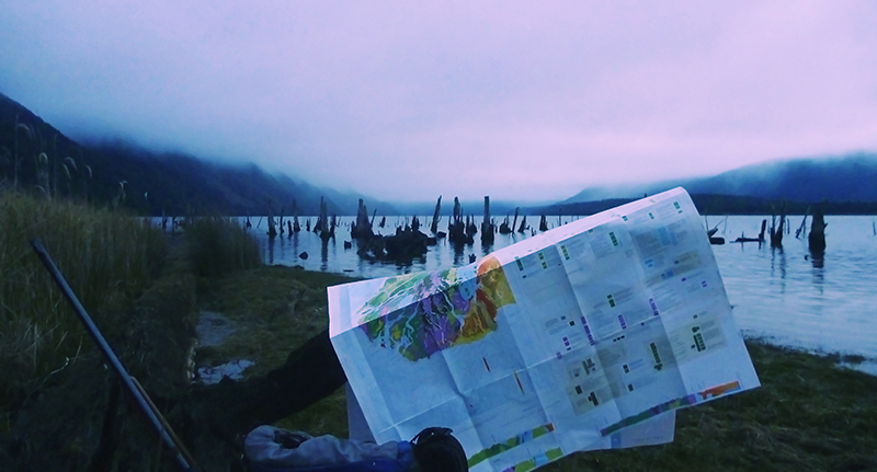
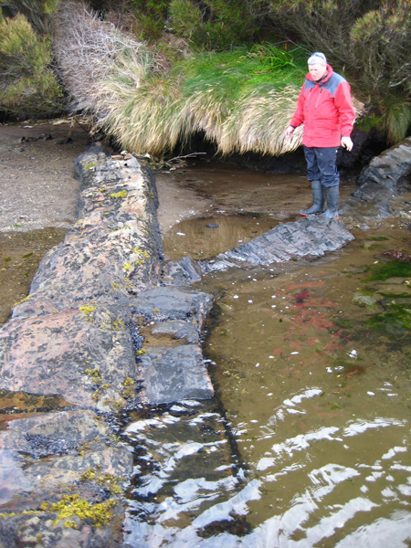
A race against the light during fieldwork on the shores of Lake Monowai, Fiordland National Park.
Photographer: Ewen Rodway
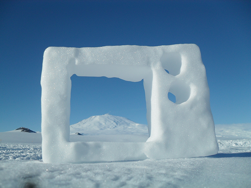
Volcanologist TV. Live view of Mt. Erebus featuring today! Ross Island, Antarctica.
Photographer: Daniel Jones
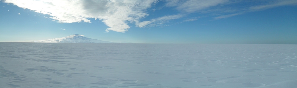
The vast emptiness of the Ross Ice shelf is interrupted by Mt. Terror on the horizon. Ross Ice Shelf, Antarctica.
Photographer: Daniel Jones
Red Mountain in South Westland. Foreground to distance: diorite, serpentine, peridotite, schist.
Photographer: Nicolas Barth
Examining the Dun Mountain Ophiolite Belt in Mt Aspiring National Park.
Photographer: James Scott
Geologists hiking down the barren and rugged ridge to Hunters Hut, Red Hills, Nelson
Photographer: Charlotte Buxton-Blue
Geologists traverse the iron-rich landscape of the Red Hills Ultramafic Massif.
Photographer: Zoe Reid Lindroos
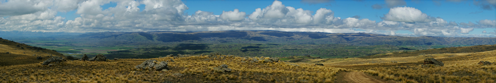
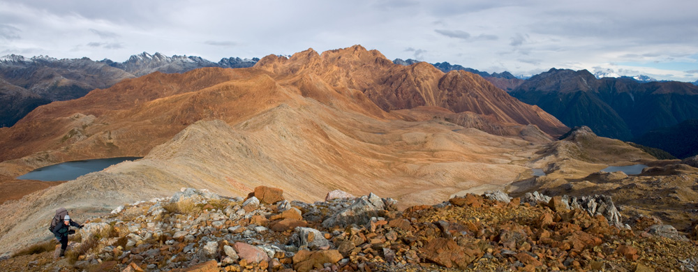
Looking east towards the Rock and Pillar Range from atop Rough Ridge.
Photographer: Sam Bain
Rock formations, Valley of Love, Cappadocia, Turkey
Photographer: Alan Cooper
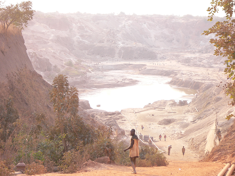
Artisanal miners re-working an abandoned open pit Cu/Co mine in the Democratic Republic of Congo
Photographer: Simon Sheppard
Breakfast on the Polaris II
Photographer: Chris Green
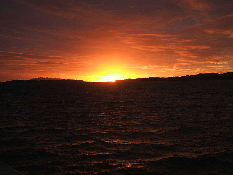
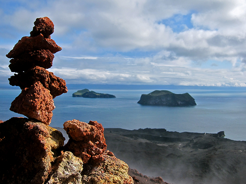
Sunset over the volcanic hills of Campbell Island from Perseverance Harbour
Photographer: Andrew Gorman
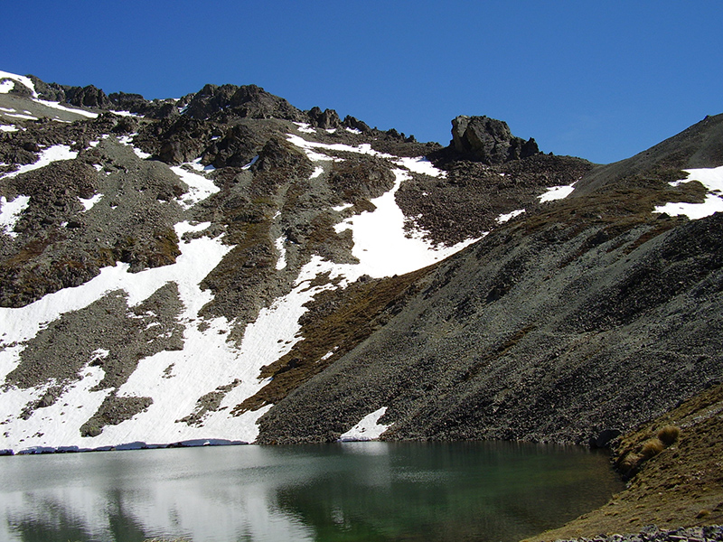
An alpine tarn surrounded by snow capped schist.
Photographer: Jesse Loughnan
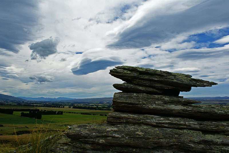
Precariously balanced schist at the apex of a tor overlooking the Strath Taieri Valley
Photographer: Sam Bain
Field category
Blending in with the locals; fieldwork upon Macfarlane Ridge, Haast.
Photographer: Sophie Briggs
Demonstration of how to take a photograph of outcrops with a proper scale, Alpine Fault footwall rocks
Photographer: Hannah Scott
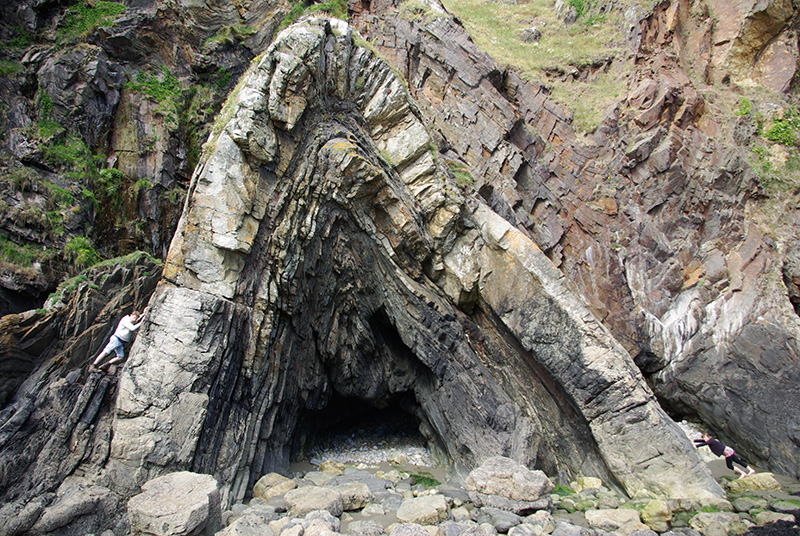
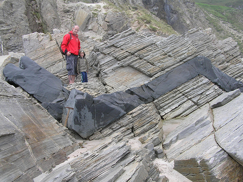
An imposing anticline on the coast of Pembrokeshire, south Wales. People show both scale and inferred direction of compression.
Photographer: Pont Lurcock
Students examining a 3m wide intrusive basalt dike at Acadia National Park in Maine, USA
Photographer: Zack Churchill
Bifurcating dykes - Camp Cove, Campbell Island
Photographer: Andrew Gorman
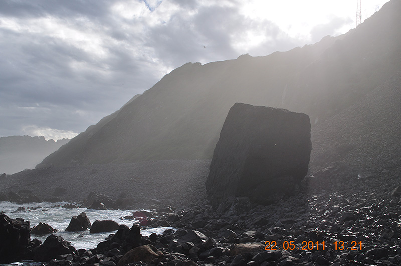
Fallen block of columnar basalt on the beach at the base of a landslide at Blackhead Quarry. Basking in the mid afternoon sun.
Photographer: Rob Choveaux
Quartzose sandstone of the Brunner Coal Measures, edge of the Denniston Plateau, Buller.
Photographer: Lucy Molony
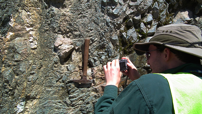
Dunedin Volcanic complex, Second Beach - getting hammered!
Photographer: Chris Green
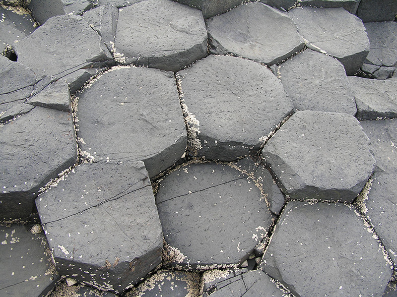
Hexagonal close packing, Giant's Causeway
Photographer: Alan Cooper
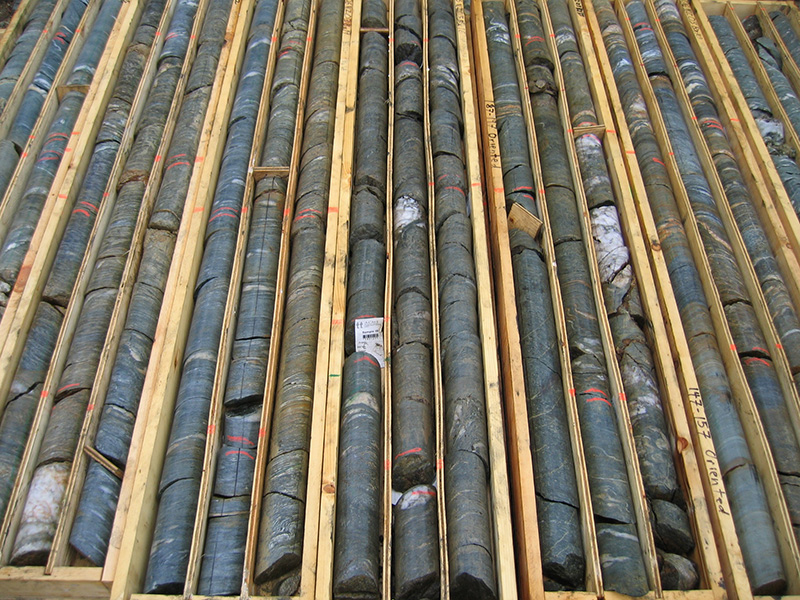
Diamond drill core from an exploration prospect in the Yukon, Canada.
Photographer: Doug MacKenzie
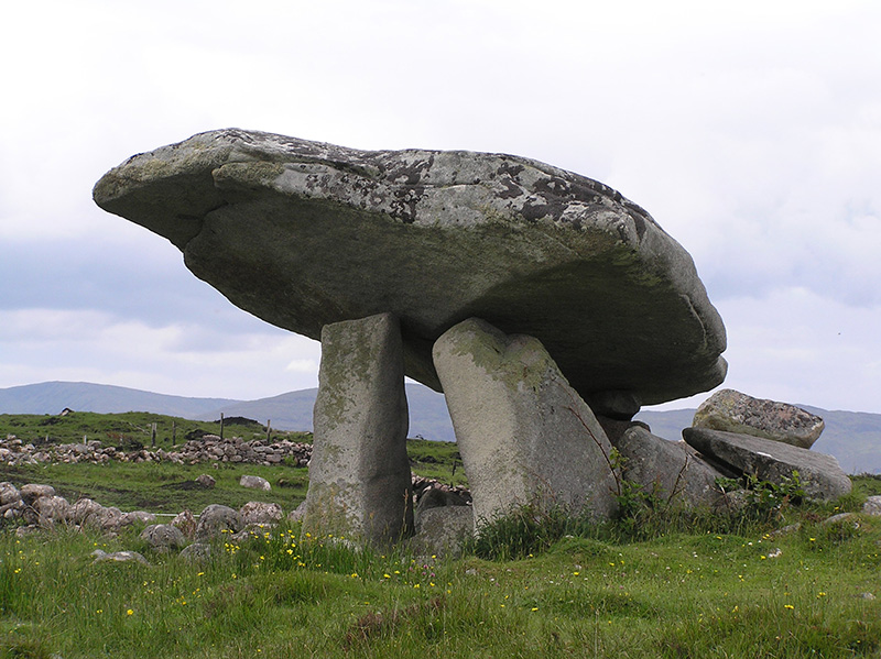
Dolmen (megalithic tomb), Donegal
Photographer: Alan Cooper
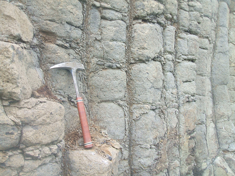
Dyke and sill intrusion into Dalradian quartzites, Donegal
Photographer: Alan Cooper
Mapping a mafic dike in the Red Hills ultramafic massif
Photographer: Charlotte Buxton-Blue
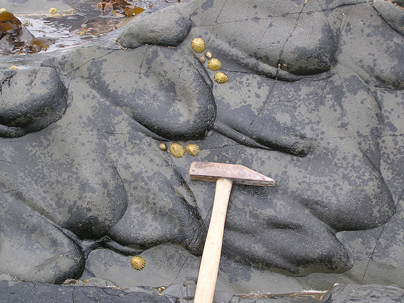
Flute casts in Paleozoic greywacke, County Down, Northern Ireland
Photographer: Alan Cooper
Fluted ignimbrite, Cappadocia, Turkey
Photographer: Alan Cooper
A seismic survey below the Franz Josef glacier. One of the more scenic and busy field locations to visit.
Photographer: Sam Bain
Heimaey Island, South of Iceland. The rocks in the foreground are from this recent eruption, while volcanic islands in the background were formed millions of years ago.
Photographer: Conor Maginn
Laki Lava, Iceland
Photographer: Jack Ensor
Laki Lava, Iceland
Photographer: Jack Ensor
Young marine fossils found at 400m elevation adjacent to the Alpine Fault. Dating these shells will provide a great constraint on Alpine Fault uplift rates in the area.
Photographer: Nicolas Barth
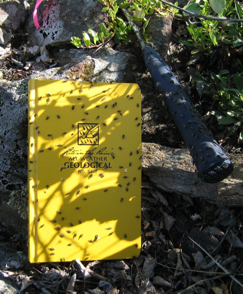
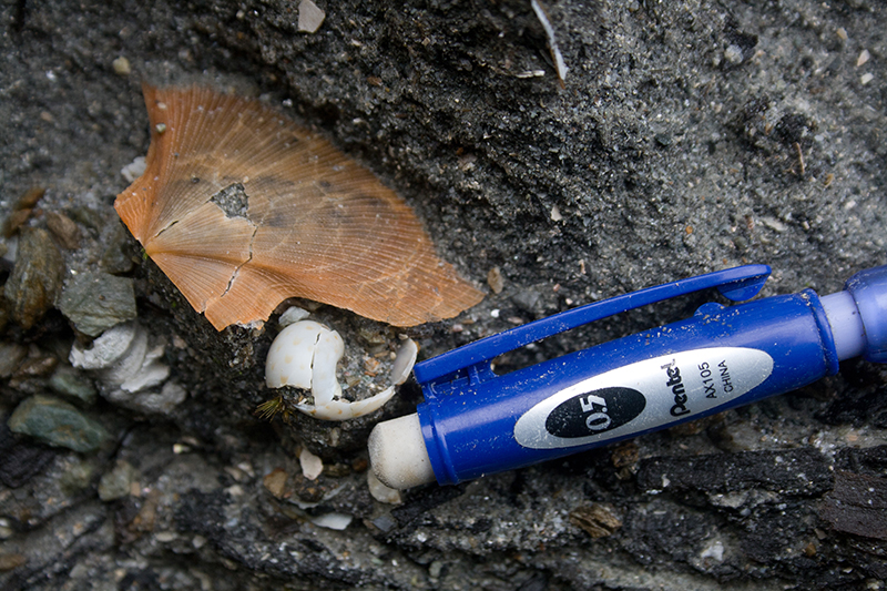
Sandflies await their meal
Photographer: Doug MacKenzie
Minimalist geological approach to field work in the Otaio Gorge... where do they put the rocks?
Photographer: Kate McKercher
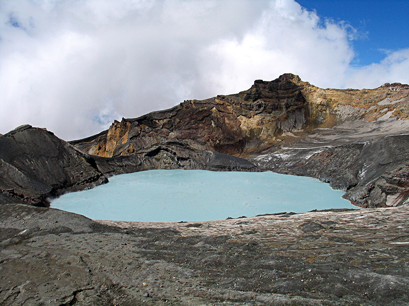
Mount Ruapehu's steaming Crater Lake surrounded by andesitic lava and tephra. The collapse of the lake rim has generated devastating lahars in the past.
Photographer: Uwe Kaulfuss
A sinister swimming companion guarding an outcrop of peridotite. Red Hills, Mt Richmond Forest Park.
Photographer: Ewen Rodway
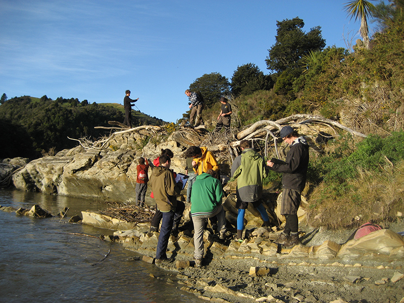
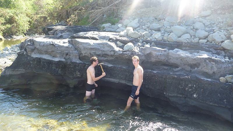
GEOL 273/373 trip to Sunnyside Bend, Borland: strat columns become less complicated when almost all your outcrop is under water!
Photographer: Bethany Fox
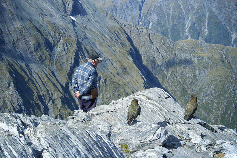
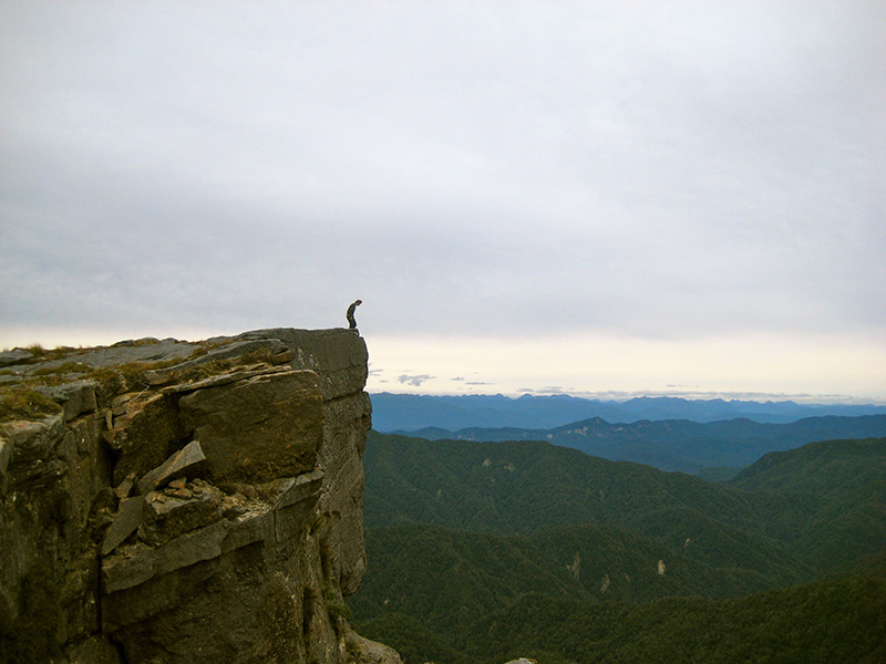
A large offset fault in the Sinclair Mountains. Thar for scale.
Photographer: Jesse Loughnan
Micro scale category
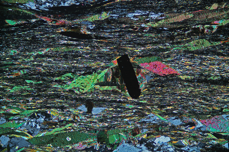
Alpine Fault cataclasite, with grains of quartz at different stages of fragmentation
Photographer: Hannah Scott
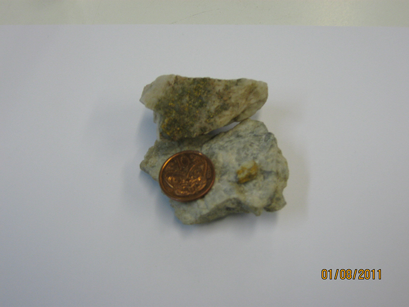
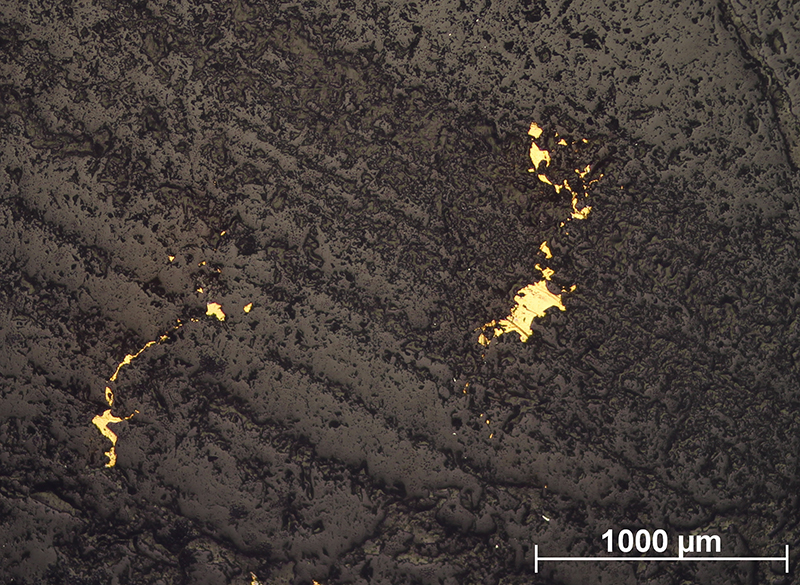
Disseminated gold in quartz, from the 627 metre deep Waiuta mine. Coin as scale.
Photographer: Jesse Loughnan
Large rectangular grain of ilminite at a high angle to foliation. Large grains of mica have grown in the strain shadow of the ilminite.
Photographer: Sam Bain
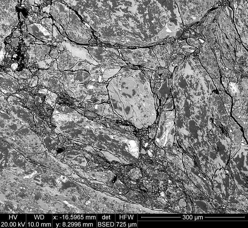
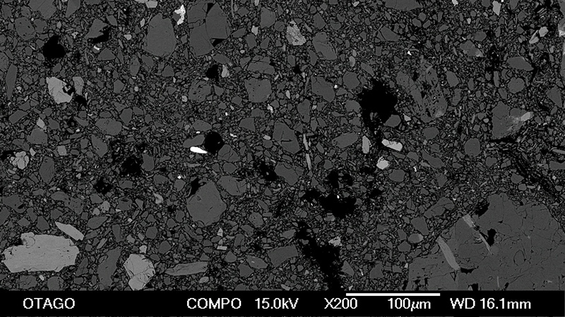
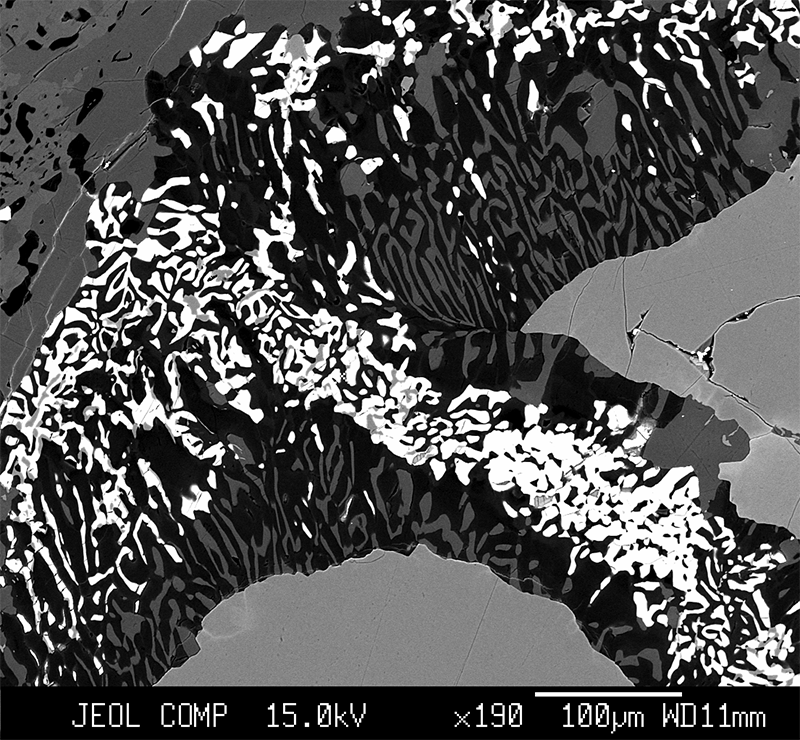
Backscatter image of low friction Alpine Fault gouge from the southern Alpine Fault at 200x. Dark shades are quartz, midtones are calcite, and most light shades are sphene.
Photographer: Nicolas Barth
Pyrite in glauconitic siltstone from the Abbotsford Formation at Fairfield Quarry near Dunedin, photographed under transmitted and reflected light.
Photographer: Pont Lurcock
Reefton gold at the micro-scale
Photographer: Ant Rayner
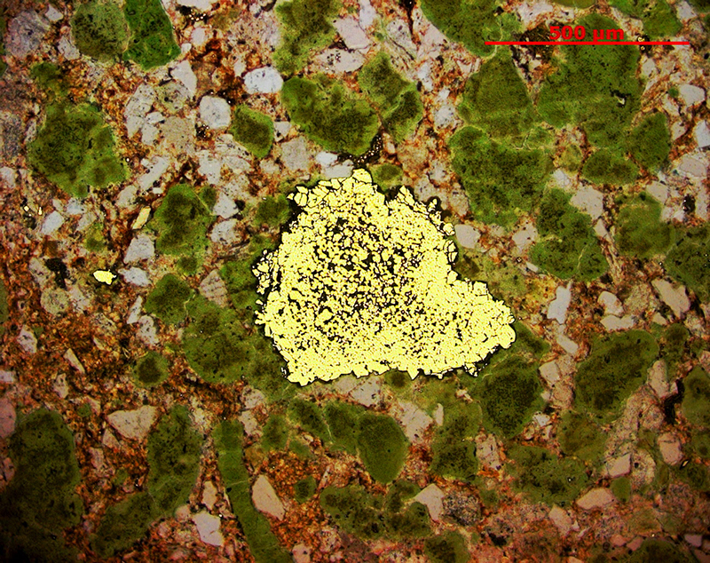
Infiltration of a hot fluid at low pressure has caused formation of olivine-spinel-plagioclase symplectites and then wormy amphibole-plagioclase kelyphites after eclogite facies garnet. Backscattered electron image.
Photographer: James Scott
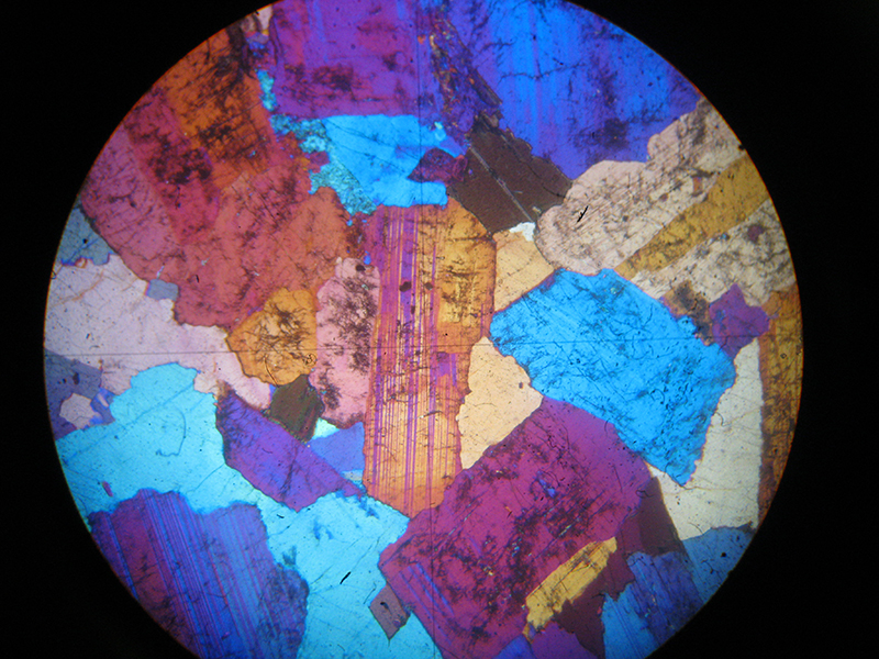
Thin section of Westland Granite with crossed polars and sensitive tint plate inserted. Field of view is 5mm.
Photographer: Joe Vincent
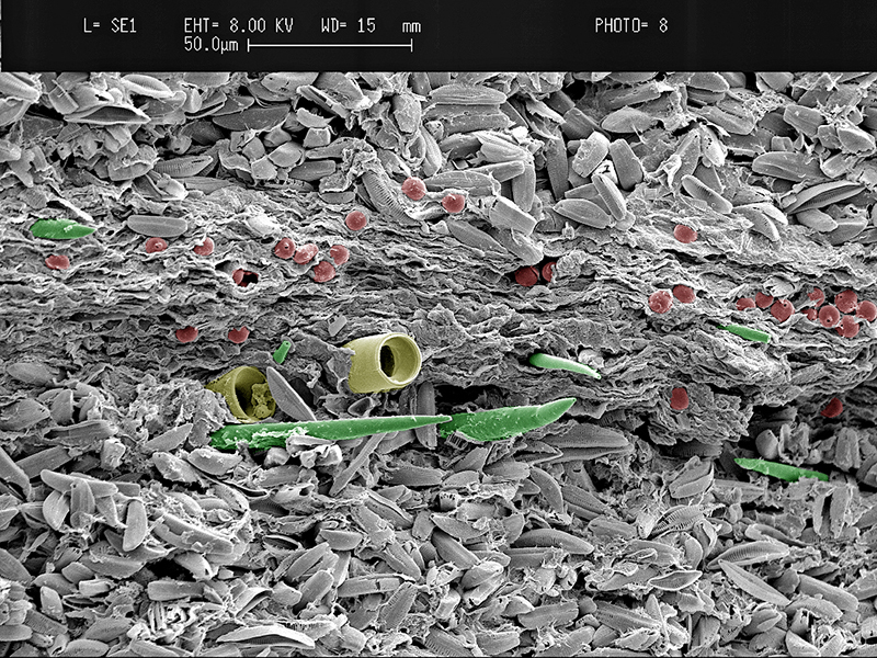
Varved lake sediment from the early Miocene Foulden Maar, Otago. Summer/spring laminae consisting of siliceous frustules of pennate diatoms alternating with an autumn/winter lamina of fine organic detritus, centric diatoms (yellow), sponge spicules (green), and algal resting spores (red). Colors in this SEM image are artificial.
Photographer: Uwe Kaulfuss
Note: Photos are for non-commercial use only. Please acknowledge photographer