The Department of Geology has been involved in a detailed study of the Alpine Fault and Southern Alps since the late 1970s. Our research programme is currently funded by FRST in conjunction with the Institute of Geological and Nuclear Sciences, and by the University of Otago. We collaborate with a number of national and international groups.
The Alpine Fault

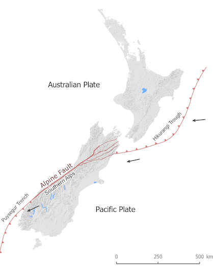
In the southwest of New Zealand the Alpine Fault joins the east-directed Puysegur subduction zone while in the north, it splits into several strands that link with the west-directed Hikurangi subduction zone. Plate tectonic calculations give a slip rate across the boundary of 36 mm/yr dextral strike-slip and 11 mm/yr convergence. The latter results in the thrusting of the Pacific plate over the Australian to form the rapidly uplifting Southern Alps. Although the Alpine Fault accommodates a substantial amount of interplate slip, a significant proportion is distributed to the east within and east of the Southern Alps.
Alpine Fault virtual field trip
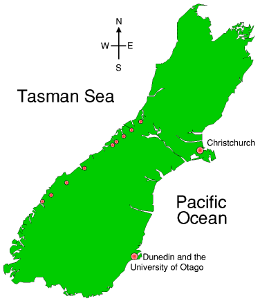
This demonstration allows you to go on a virtual field trip along the Alpine Fault and see some of the key outcrops. Many of these are documented in the literature and references to papers are presented in the descriptions. The sites are shown on the accompanying map – click on the red dot to view photos of that area.
Localities on the Virtual Field trip
- Kakapotahi River
- Harold Creek
- Gaunt Creek
- Franz Josef
- Hare Mare
- Haast
- South of Haast
- Martyr River and Cascade River
- Lake McKerrow
- Milford Sound
Map of localities on the Alpine Fault virtual field trip
Please click on any location to jump to that stage of the tour.
