 UK
UK
PhD title: Investigating the eruptiveprocesses of shallow-marinevolcanoes on the Oligocenecontinental shelf, east Otago, New Zealand
Supervisor: James White
Email: blm687@gmail.com
Summary of Research project: Background and aims
The North Otago region of the South Island of New Zealand iswell known for its volcanic deposits, including, the Boatmans Harbour PillowLava and the Kakanui Mineral Breccia which have had notable interest fromgeologists since the late 1800's. Three distinct periods of volcanism are knownto have occurred throughout the Cenozoic, the first being of Paleocene age describedfrom an occurrence of basaltic tuff in an exploration well 17 km off the coastof Oamaru. The second period is of late Eocene to early Oligocene age, coveringan area of roughly 60 km by 30 km and includes the coastline from north Oamaruto south Moeraki. The third period of volcanism is found in eastern and centralOtago and is much more wide spread than the previous volcanic periods, forexample the Dunedin volcano in the middle Miocene (Coombs et al., 1986).
This project is designed to work on the second phase ofvolcanic activity which encompasses several well preserved monogeneticintraplate volcanoes known as the Waireka-Deborah volcanic group which eruptedonto a submerged continental shelf between 35-30 Ma producing Surtseyanvolcanoes (Fig. 1). The aim of the project is to gain a volcano by volcano interpretationof shallow-marine eruption processes by better understanding (1) precise depositionalprocesses, bed by bed; (2) how the currents or suspensions that formed thebeds were produced by the eruption along with the effects of these; (3)the current-generating or suspension- generating processes above the vent forparts of the eruption which we can be sure were erupted subaqueously(e.g. lowest beds of the volcano); (4) thepoint we can recognize, and characterize when the eruption became emergent;(5) the variation in eruptive activity; (6) a possible water depth for thetime of eruptive activity and (7) what the same magmatic feeding system wouldhave produced if the eruption were subaerial rather than subaqueous (usingsome analogous deposits for this).
At thisstage field work is focused near Oamaru including analysis of well exposed pyroclasticand reworked volcaniclastic rocks, pillow lavas, hyaloclastite breccias andcontemporaneously deposited shelf sediments and limestones. The view is tocompare these with other areas along North Otago.
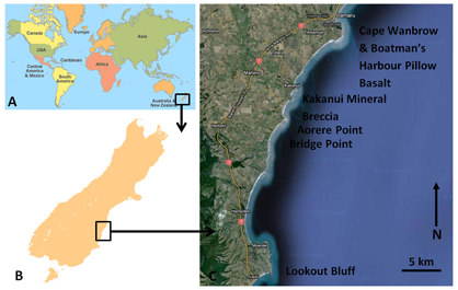
Fig. 1 –Location of Study area along the North East Otago coastline, South Island, New Zealand
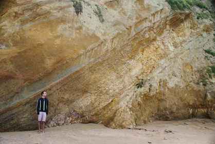
Fig. 2 - Fossil rich volcaniclastic beds south of Cape Wanbrow
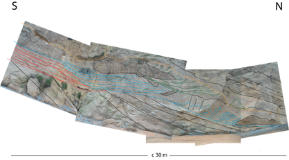
Fig. 3 – Example of complex channel systems in bedded tuffs at Cape Wanbrow
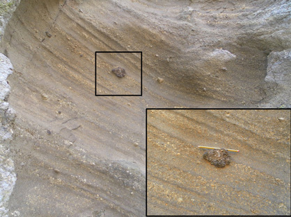
Fig. 4 – (A) Planar to undulated lapilli tuffs and fine- to coarse- grained tuffs at Bushy Beach, Cape Wanbrow. Vesicular to non-vesicular bombs present throughout sequence
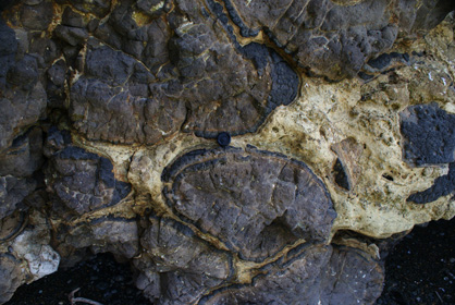
Fig. 7 - Pillow basalts at Boatman's Harbour with limestone within the interstices
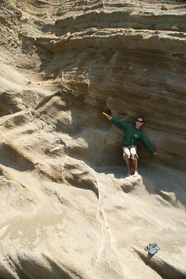
Fig. 8 – Example of typical bedded lapilli tuffs and ash tuffs around Cape Wanbrow
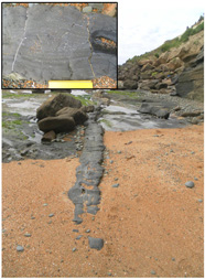
Fig. 9 – Thin dike found around Cape Wanbrow with banded vesicles

Example log of bedded tuffs and lapilli tuffs around Cape Wanbrow
Previous Work
MGeol Thesis 2011 : Departmentof Geology, University of Leicester, UK
Supervisors:Dr. M. J. Branney & Dr. J. Zalasiewicz
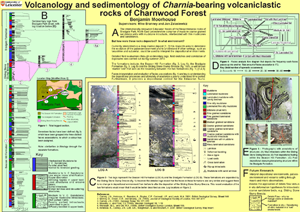
Volcanologyand Sedimentology of Charnia bearing rocks of Charnwood forest
The relics of a rhythmic pattern of deposition are preservedwithin the exposures of Bradgate Park, Leicestershire, UK. They occur withinthe late Proterozoic Maplewell Group of the Charnian Supergroup and include thefamous Ediacaran fossils. The succession consists of 22 similar stratigraphicsequences that together record a cyclic sedimentary pattern. Each sequence isunique in detail but all comprise a similar depositional structure,recognizable by six lithofacies.These lithofacies include; massive and parallel laminated mudstones, massiveand parallel laminated silty sandstones, massive to parallel laminated coarse-to fine-grained sandstones, undulose interstratified fine-grained sandstone andmudstone, fine- to coarse-grained sandstone with mudstone intraclasts andmassive to internally laminated and cross-laminated fine- to coarse-grainedsandstones with fluidization structures. Each sequence is interpreted as aseries of turbidity currents representative of Bouma divisions A through to Erepresenting what appears to be a subtle progradational cycle, terminating oroverlain by a debris flow deposit. This has further significance as therepetition of such depositional sequences means that cycles could be either autocyclicor controlled by high frequency sea-level fluctuations and/or have a possiblemilankovitch control factor. The lack of wave-reworked structures and ofinternal erosive surfaces indicates deposition below storm-wave base. Theabundance of soft-state deformation including, convolute lamination, down-sag,syn-sedimentary faulting and fluidization within the deposits suggestssedimentation occurred in a highly unstable environment, prone to slumping.This is further supported by the in-situ break up of finer bedded material toform clasts within a coarse grained matrix. The cyclic pattern has furtherimplications for the understanding of Ediacaran fossils found within the deepwater parts of the sequence.
Volcanology-and-sedimentology-of-Charnia-bearing-volcaniclastic-rocks-of-Charnwood-Forest.pdf
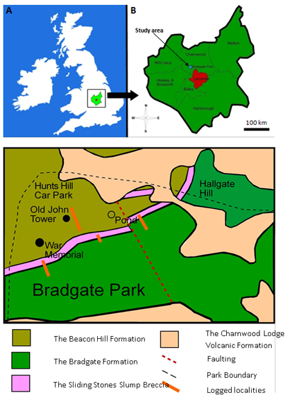
Fig. 1 (A) Location map of the study are Leicestershire with central England. (B) Location map of the study area within the Charnwood District, Leicestershire. (C) Simplified geological map of the north of Bradgate Park with logged sections highlighted (Modified from Ambrose et al. 2007).
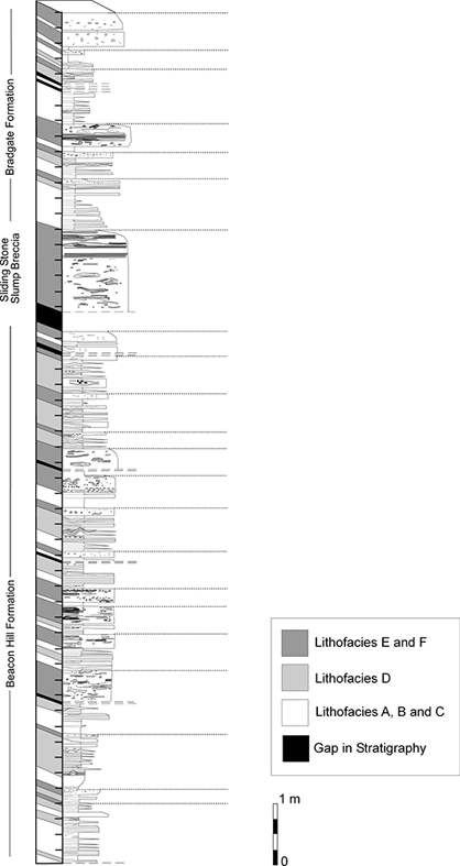
Fig. 2 - Measured section from the most westerly point of the Bradgate Park exposures. Small spaced dashed line represents the start of a new stratigraphic sequence containing variations of facies A-F.
