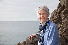

Associate Professor Pat Langhorne
“So what we would like to do is have a better picture, or a better understanding, of what contribution these ice shelves have to sea ice around Antarctica.”
Satellite images can tell scientists a lot about the formation, cover and break-up of sea ice around Antarctica, but they can't show how thick that ice is or how it forms around ice shelves that clad almost half of the southern continent's coastline.
To understand that process three hardy souls, including two physicists from the University of Otago, wintered over at Scott Base in 2009 and successfully obtained the first year-round oceanographic data clearly showing the transition in McMurdo Sound from winter to summer and back to winter again. Scientists have been working at McMurdo Sound for 100 years and have built up an extensive knowledge of the area in relation to the rest of the continent.


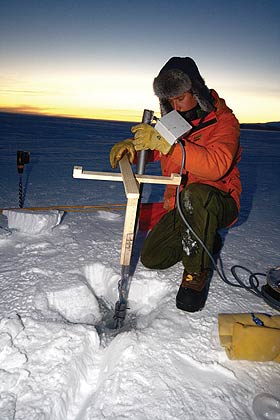
PhD student Alex Gough installs a string of sensors to record sea ice temperature.
Photo: Andy Mahoney
Co-leader of the winter sea ice project, Associate Professor Pat Langhorne (Department of Physics) says the broad objective of this research was to provide baseline information on climate change. The group specifically focused on the interaction between the ocean, sea ice and the ice shelf.
Langhorne explains how super-cooled water from the interaction of the ocean with the ice shelf acts as a heat sink in which ice crystals nucleate and grow. These crystals, or platelet ice, accumulate in porous layers under the ice and become incorporated into the fabric of sea ice.
Venturing on to sea ice through the 2009 winter was technically challenging and not without its risks for the three who wintered over, Otago postdoctoral fellow Dr Andy Mahoney, Otago PhD student Alex Gough and Antarctica New Zealand field assistant Brian Staite.
All three are highly experienced working in a polar environment, but safety was still of paramount importance for project co-leaders Langhorne and Dr Tim Haskell, of Industrial Research Ltd.
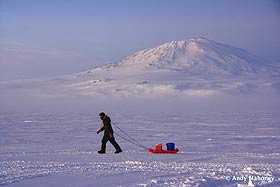
The team worked from Scott Base, but spent up to three days at a time travelling across sea ice on McMurdo Sound and working in total darkness and rigorous winter conditions. During that time, the trio were on their own, without any hope of support or rescue by boat, aircraft or helicopter.
They conducted experiments at two sites: one on multi-year sea ice at Cape Armitage that was relatively safe and then on first-year sea ice at Erebus Bay. This ice was only 60cm thick when the team first worked on it.
Sea ice is dangerous from February through to May when storms and swells can break it up with little warning. Two men were lost from the Ross Sea party of Antarctic explorer Sir Ernest Shackleton on sea ice on this area of McMurdo Sound in May, 1916.
“That's one of the challenges of working there,” Langhorne says. “In fact, sea ice break-up was always my biggest worry because it happens very fast. We breathed a big sigh of relief to get everyone back safely, but to have such excellent data as well is really the icing on the cake.”
The Antarctic Sea Ice Group – which includes scientists from the University of Otago, Victoria University and Industrial Research Ltd, polar oceanographers from NIWA and field support from Antarctica New Zealand – is currently analysing the data collected over a full year to work out the effects of water cooled by the ice shelf on the sea ice of McMurdo Sound.
They want to learn what contribution the ice shelf makes to sea ice thickness, then build this into a conceptual model of what is happening in McMurdo Sound, with the eventual aim of applying that model to the whole continent.
“So what we would like to do is have a better picture, or a better understanding, of what contribution these ice shelves have to sea ice around Antarctica,” Langhorne says.
“Although sea ice influences the climate and the ocean underneath, we still don't have a reasonable picture of how thick that sea ice is.”
This research has direct relevance to New Zealand. With our location only 1,500 kilometres from the edge of the winter sea ice, the oceans surrounding New Zealand are influenced by sea ice around the southern continent.
Funding & Support
- Foundation for Research, Science and Technology
- Antarctica New Zealand
- NIWA
- Industrial Research Ltd
- University of Otago
- Victoria University of Wellington