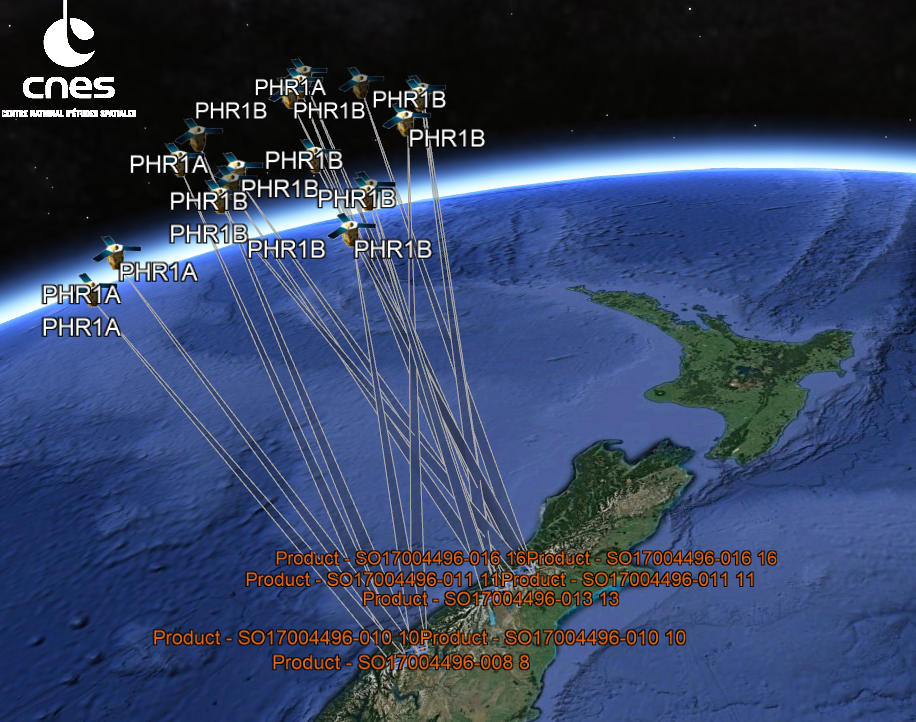
The Matariki project is funded by MBIE Endeavour Smart Idea to transform environmental monitoring by quantifying environmental resources through high-resolution, automated, satellite mapping of landscape change. The Earth is a dynamic system—Trees grow, alpine snow melts, landscapes erode, and tectonic plates collide, sometimes with dramatic consequences. These environmental changes produce measurable variations in surface elevation. This project will develop a novel way to make 3D-change maps with unprecedented detail and sub-metre accuracy.
'Matariki' is the Māori name for the cluster of stars known as the Pléiades. It rises in mid-winter and for many Māori, it heralds the start of a new year. Matariki literally means the 'eyes of god' (mata ariki) or 'little eyes' (mata riki)” (from https://teara.govt.nz/en/matariki-maori-new-year)). Pléiades is also the name of the satellite constellation operated by Airbus DS and from which we received early support via the French Space Agency CNES and Pléiades Glacier Observatory programme (PGO).
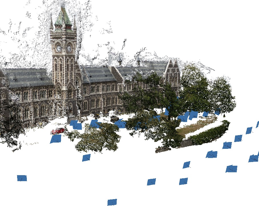
| Stereo satellite photogrammetry | Computer vision | 3D-change detection |
|---|---|---|
 |
 |
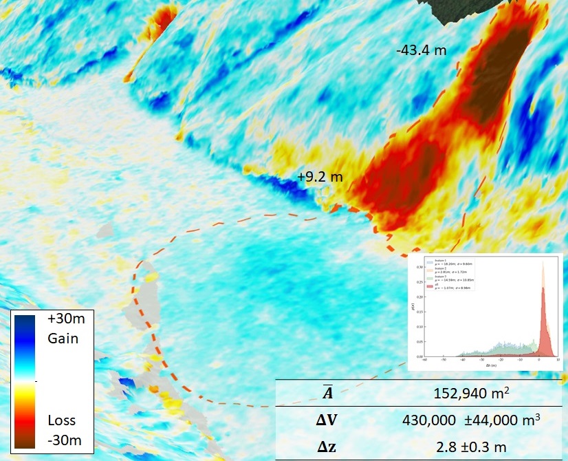 |
| The science of making measurements from images...from even further away. | The science of computer that can see... by themselves. | Detect where and by how much things have changed...in 3D |
What could you do if you had these products within 48h?
Our promise: Easy accessible automatic 3D-change detection
Check out more products (restricted area)...
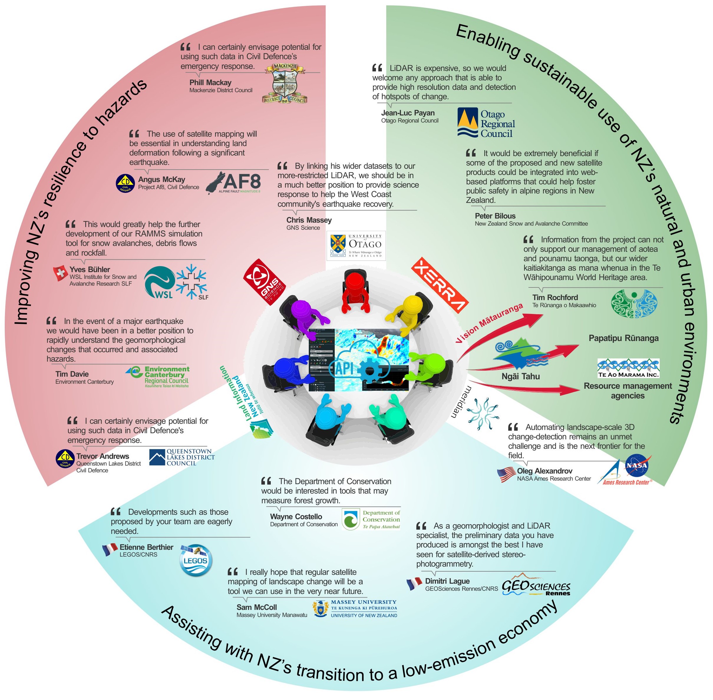
SUPPORT FROM END-USERS
What partners, collaborators, and potential end-users have to say about our project
Vision MĀtauranga
Unlocking the science and innovation potential of Māori knowledge, resources and people
The responsibility of kaitiakitanga is felt deeply by Te Rūnanga o Ngāi Tahu because our landscape and its resources are the main inheritance we will leave future generations. There is an overarching whakatauki that guides management natural resources including pounamu. “Tiakina he tino taonga pounamu mō tātou, ā, mo kā uri ā muri ake nei” (Care for the precious treasures for all of us and our children who follow us). To do so, however, is not straight forward as it requires underpinning information on sustainability of these resources. A key outcome of this landscape mapping project is to provide information on erosion and other natural processes of change, and how they affect the rates of supply of mineral taonga, change habitats, or threaten archaeologically significant sites.
Te Rūnanga o Makaawhio are one of the eighteen Ngāi Tahu papatipu rūnanga and represent the interests and aspirations of the Kāti Māhaki hapū. Through ancestral and spiritual connections Kāti Māhaki exercise kaitiakitanga (stewardship) over their takiwā (defined hapū territory) in South Westland, which includes the West Coast Area of Interest (AOI) proposed for this study as well as much of the Te Waipounamu World Heritage area. The hapū identify the Makaawhio Awa (river) as their principal freshwater body and where tino taonga (treasure) they call ‘Aotea’ - distinctive, rare, blue and green stones- are found. As mana whenua in South Westland they are also kaitiaki of all pounamu between Piopiotahi (Milford Sound) and Hokitika River.
Like all elements of Te Ao Māori (the maori natural world) aotea and pounamu have whakapapa, although there are varying versions. For many these mineral taonga are a gift from papatuanuku. To some they represent the manifestation of goddesses cast into stone by the warrior taniwha Poutini, with a feminine wairua (spirit) imbued with healing powers. Most aotea and pounamu now occur as rare clasts in the riverbed, carried by floods on its journey Ki uta Ki Tai (from the mountains to the sea). Whānau feel strongly that time spent searching for these taonga reinforces their spiritual, emotional and physical connection to land and place, identity and whakapapa. There are deeply felt issues around use of these resources.
Pounamu also occurs in the Wakatipu region, where there are seven Otago and Southland papatipu rūnanga tasked with kaitiakitanga. Here there is great interest and concern over rapid landscape change associated with the landslide Te Horo in Dart valley, which threatens archaeological sites and pounamu in the sacred Te Koroka topuni area. Te Ao Marama Inc was formed in 1996 to take on the role of looking after tangata whenua interests in resource management and other aspects related to the local government of Southland. They act as the principal conduit between Otago Southland councils and rūnanga who hold mana whenua over ancestral lands in Murihiku. Their support of this project will be particularly helpful for understanding māori perspective and disseminating results from the Queenstown AOI. Due to the legacy of datasets already available, the Dart area is a high-priority area for operational roll out once techniques are finalised.
The Aoraki AOI also includes a topuni and the protective cloak placed on Aoraki - one of the most sacred ancestors from whom Ngāi Tahu descends. The ancestor embodied in New Zealand’s highest mountain remains the physical manifestation of a link between the supernatural and the natural world. Given that Aoraki gives the iwi with its identity, solidarity and purpose, our project expects to be closely involved with Ngāi Tahu at both tribal and papatipu rūnanga level. Dr Cox and GNS Science have been supporting Ngai Tahu’s aspirations around mineral resources for nearly two decades by developing scientific methodology, carrying out rūnanga-led monitoring and field surveys, and undertaking resource estimates focused on the sustainability of riverbed harvesting. The development of high-resolution landscape models and change detection directly supports this research and understanding other processes shaping our landscape. The project will take landscape data quality and iwi-science relationship to the next level.