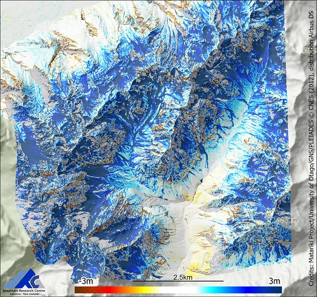
Snow depth, Jollie River catchment, Aoraki Mount Cook National Park, Winter 2012
Matariki project maps the snow depth across in the Jollie River catchment of the Aoraki/Mt Cook National Park for Deep South Challenge Modelling snow and catchment processes.

6 May 2012

22 Sep 2012

Snow depth
6 May 2012
Snow depth

22 Sep 2012